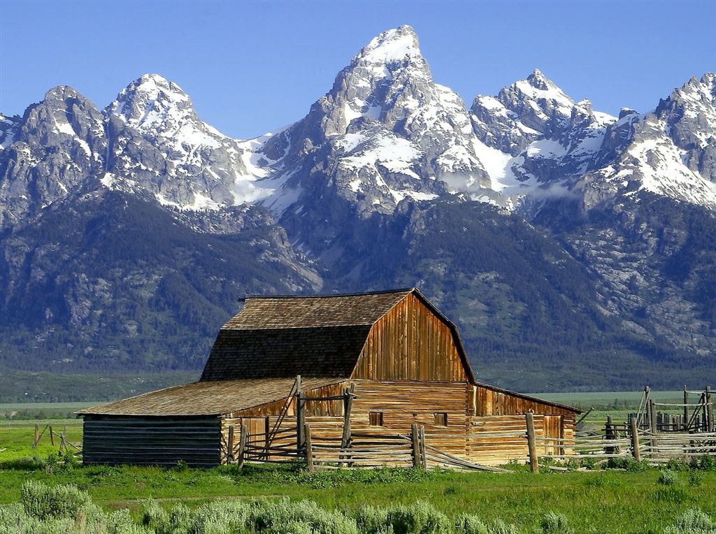
The Grand Teton National Park embraces the most scenic portion of the Teton Range of Wyoming, with an area of approximately 150 square miles, or 96,000 acres. It varies from 3 to 9 miles in width and is 27 miles in length. The northern extremity of the park is about 11 miles south of the southern boundary of Yellowstone National Park. This park was established by President Coolidge on February 26, 1929.

In addition to its sublime peaks and canyons, the Grand Teton National Park includes six large lakes and many smaller bodies of water, glaciers, and snowfields, and extensive forests of pine, fir, spruce, cottonwood, and aspen. However, much of the park area is above timber line (10,500 feet), the Grand Teton rising to more than 7,000 feet above the floor of Jackson Hole.
The great array of peaks which constitutes the scenic climax of this national park is one of the noblest in the world. It is alpine in the truest sense. Southwest of Jenny Lake is a culminating group of lofty peaks whose dominating figure is the Grand Teton, the famous mountain after which the park takes its name. The resemblance of this group, whose clustered, tapering spires tower aloft to a height of thousands of feet and are hung with never-melting snowfields, to a vast cathedral, must suggest itself to every observer.
However widely traveled, visitors viewing the Tetons for the first time confess that the beauty of this park and the rugged grandeur of its mountains come to them as a distinct revelation. This is amply proved by the increasingly large number of visitors who return summer after summer to spend their vacations in the Grand Teton National Park. The recreational possibilities of these mountains, they have found, are practically limitless. Here they may camp on the lakes, swim and fish, ride or hike the trails,[Pg 2] engage in the strenuous sport of mountaineering, or—if their needs and wishes so dictate—simply relax and rest.
The Grand, Middle, and South Tetons comprise the historic Trois Tetons, which were noted landmarks to the trappers and explorers of the early nineteenth century. The Three Tetons are seen to best advantage from the west and southwest. As the observer's viewpoint is shifted, the major peaks change greatly in outline and relative position, but despite this fact one soon learns to recognize each.
Eleven peaks are of such boldness and prominence that they receive rank as major peaks. In order of descending altitude they are: Grand Teton, 13,766 feet; Mount Owen, 12,922; Middle Teton, 12,798; Mount Moran 12,594; South Teton, 12,505; Mount Teewinot, 12,317; Buck Mountain, 11,923; Nez Perce, 11,900; Mount Woodring, 11,585; Mount Wister, 11,480; and Mount St. John, 11,412.
In addition to the 11 major peaks there are an even larger number of lesser prominence and altitude, such as Cloudveil Dome, 12,026 feet; Eagle Rest, 11,257; Prospectors Mountain, 11,231; Mount Rockchuck, 11,150; Table Mountain, 11,075; Bivouac Peak, 11,045; Rendezvous Peak, 10,924; Fossil Mountain, 10,912; Rolling Thunder, 10,902; Mount Hunt, 10,775; Symmetry Spire, 10,546; and Storm Point, 10,040, as well as a host of nameless pinnacles and crags which serve still further to make the Teton skyline the most jagged of any on the continent. The larger lakes of the park—Leigh, String, Jenny, Bradley, Taggart, and Phelps—all lie close to the foot of the range and, like beads, are linked together by the sparkling, tumbling waters of Cottonwood Creek and neighboring streams. Nestled in dense forests outside the mouths of canyons, these lakes mirror in their quiet depths nearby peaks whose pointed summits rise with sheer slopes a mile or more above their level.
Video of The Park's Features